See it working
Real screenshots, real traffic
Everything below is the live product tracking real vessels — nothing staged, nothing mocked.
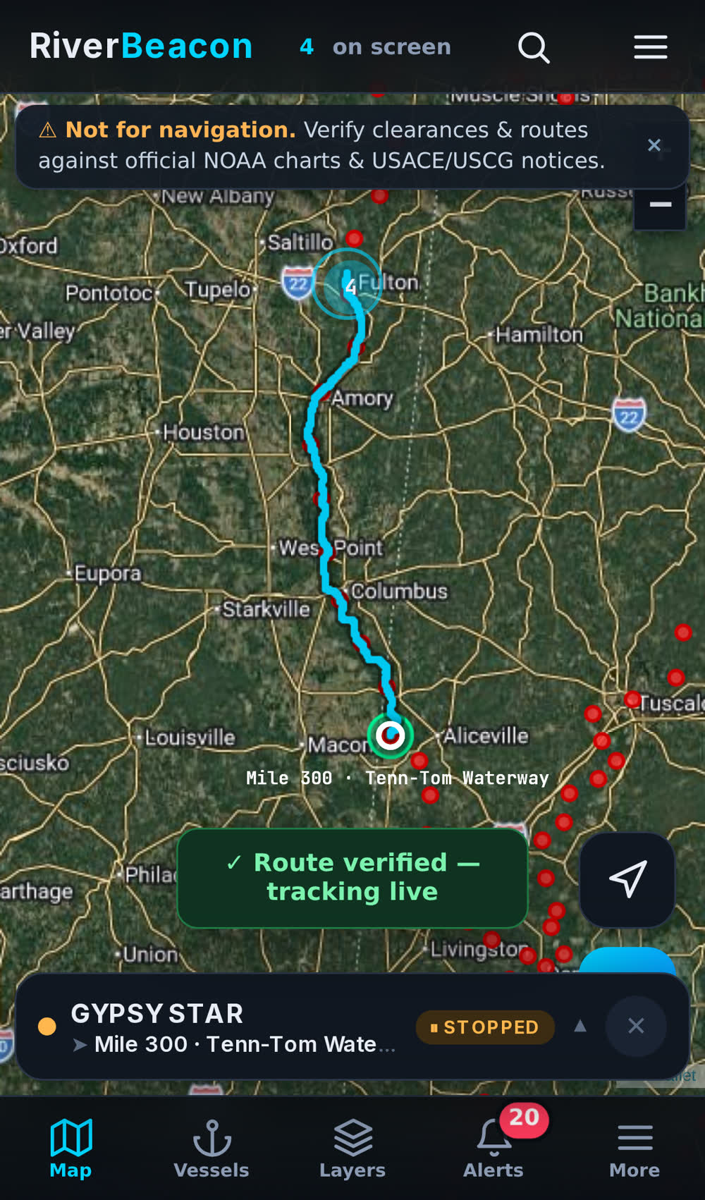
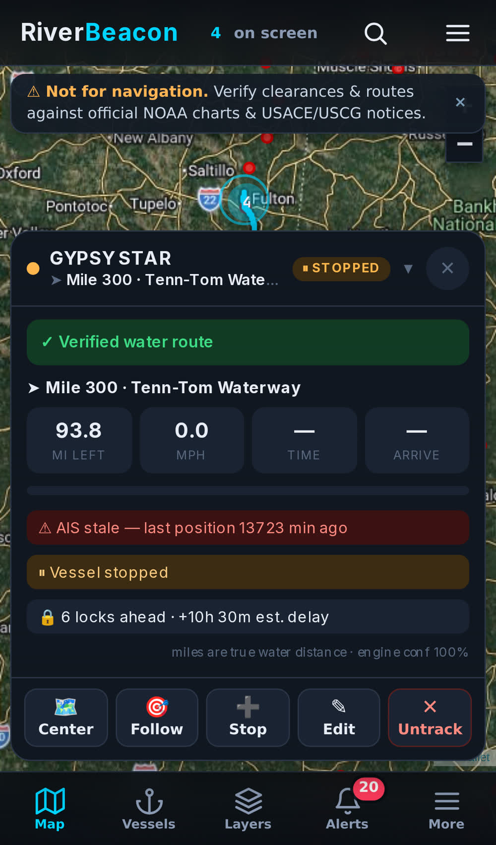
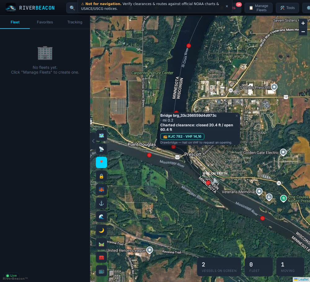
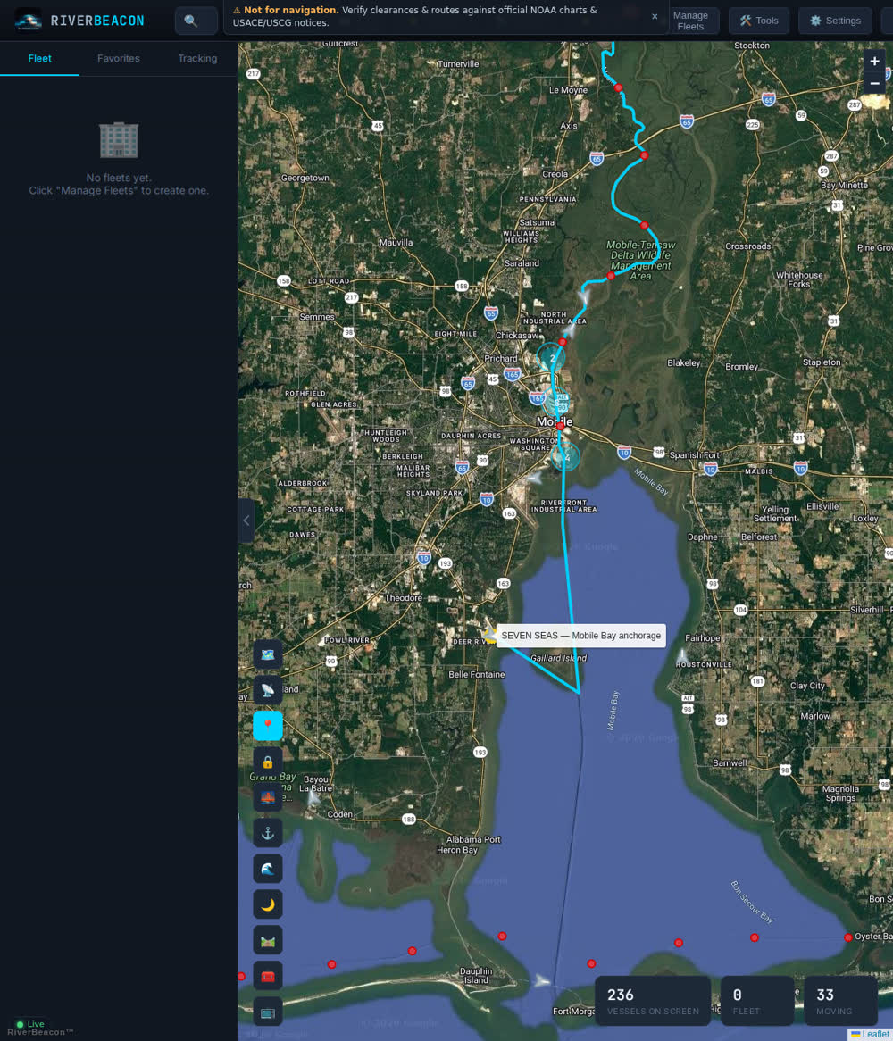
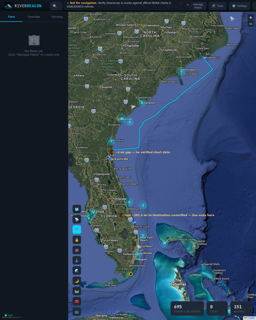
Vessel positions as they move. Water routes verified against chart geometry, measured in true statute miles. Live USACE lock queues. Bridge clearances that show the gauge, the formula, and the math. Every figure carries its source — and where a source isn't on file yet, the board says exactly that.
Built around one rule: every number traces to an official source, or the label says what's missing.
AIS plus cell-GPS relay for river dead zones. Tap any vessel for position, speed, heading, and destination — updated as it moves.
Routes follow charted navigable water end-to-end in true physical statute miles. A stretch that can't be verified is drawn as a labeled gap — never a line across land.
Source-cited charted clearances on 3,732 bridges. On 42 verified bridges the board computes today's clearance from the chart's own gauge formula — stage, formula, and result shown. Enter an air draft, get Clear / Caution / Will-not-fit.
Who's waiting at every USACE lock, up and down, barge counts, who's in the chamber, approximate delay — straight from LPMS, refreshed through the day.
Movable bridges carry closed and open clearances, operating schedules from 33 CFR 117, and — where sourced — the radio call sign and VHF channel to request an opening.
Plain-language questions — "who's waiting at Marseilles?", "nearest fuel to Lower Miss 600?", "will 48 ft clear the Cairo bridge?" Answers come only from the board's live tools. No source, no answer.
Stage and trend on 12,390 gauges with flood categories, marine weather along the run, and active Notices to Mariners.
Map-first mobile with a live route chip and one-thumb actions. Cast the board to the office TV for shift handoff.
Everything below is the live product tracking real vessels — nothing staged, nothing mocked.
Most maps guess and look finished. RiverBeacon is built the other way around — the board tells you what's on file and what still needs a source.
Every route line passes land-cut and water-containment gates before it draws. Every clearance cites its chart or publication. Anything without a source carries a plain operational label — see the legend below.
Corrections to bridge and route data carry source → old value → new value. Where the chart and a database disagreed, the chart won. 640+ corrections on file to date.
Mileage is measured along the water in statute miles, calibrated against official chart geometry — not straight-line estimates.
Current state, in the open: 42 bridges are live (verified formula + gauge + datum semantics, tested per bridge). 225 spans currently read "Official clearance not on file." Call signs are attached on 8 movable bridges so far, with a sourcing queue working through the rest. Route coverage gaps are labeled in-app where they exist.
Account setup takes under a minute — current plan pricing is shown in-app on the account page.
No. RiverBeacon is a planning and dispatch tool. It is not for navigation. Verify clearances, routes, and conditions against official NOAA charts, USACE publications, and USCG Local Notices to Mariners before transit. Full disclaimer: riverbeacon.org/legal.
Official sources: USACE navigation charts and the LPMS lock system, NOAA ENC/IENC electronic charts, NWS/NWPS river gauges, the National Bridge Inventory, and USCG drawbridge regulations (33 CFR 117). AIS positions come from terrestrial receivers plus a cell-GPS relay for river dead zones. The source is cited on the data itself.
For bridges whose official chart publishes a gauge-referenced clearance basis, the board computes today's clearance from the live river stage — and shows the gauge, the stage, and the math. Bridges without a verified basis show the charted value with the label Static charted only. No verified basis, no live number — that rule has no exceptions.
The U.S. inland river system — Mississippi, Ohio, Tennessee, Tenn-Tom, Illinois, Missouri, Arkansas, GIWW, and dozens more — plus growing Atlantic ICW coverage. Where chart data has gaps, the board labels them instead of guessing.
RiverBeacon is phone-first: the mobile board runs in any modern browser at track.riverbeacon.org (add it to the home screen). An Android app is available for enrolled fleets.
Create a free account with a username, email, and password. Paid plans unlock the full board; everything is managed from the in-app account page. No credit card required to sign up.
Fleet onboarding, data corrections (send the source), API access, or something on the river that looks wrong — every message gets read.
The RiverBeacon inbox, monitored around the clock:
[email protected]Fleet onboarding, AIS relay enrollment, data corrections with sources, and API access all start here.